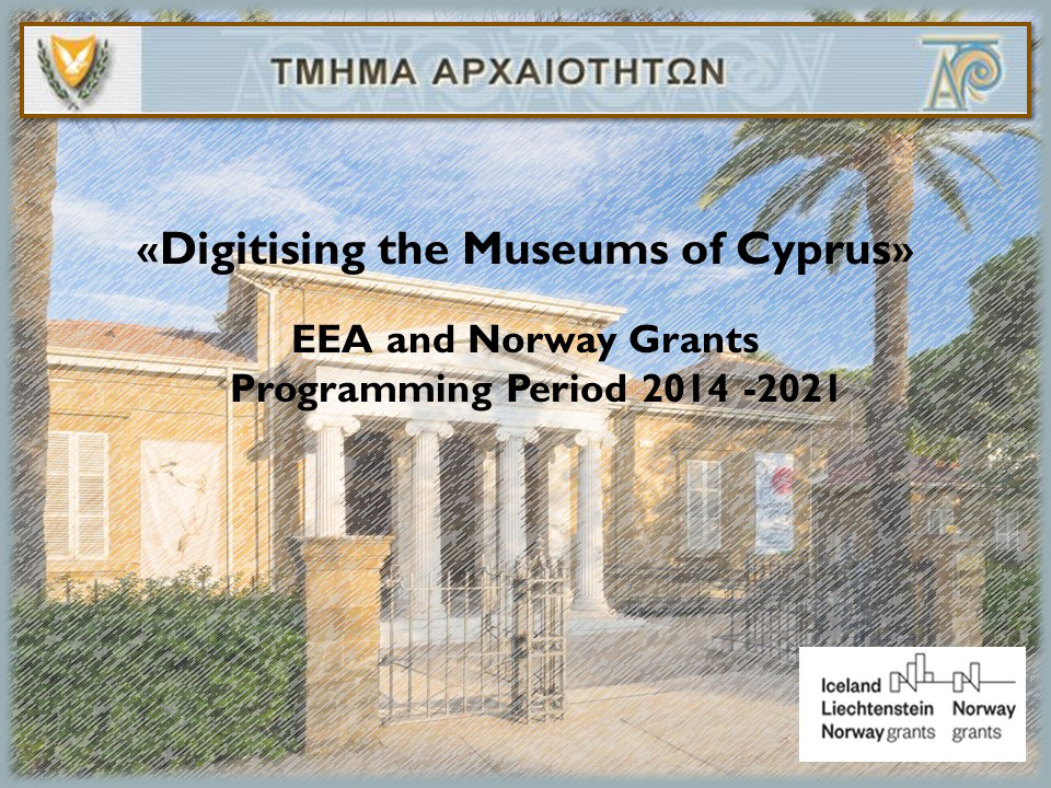
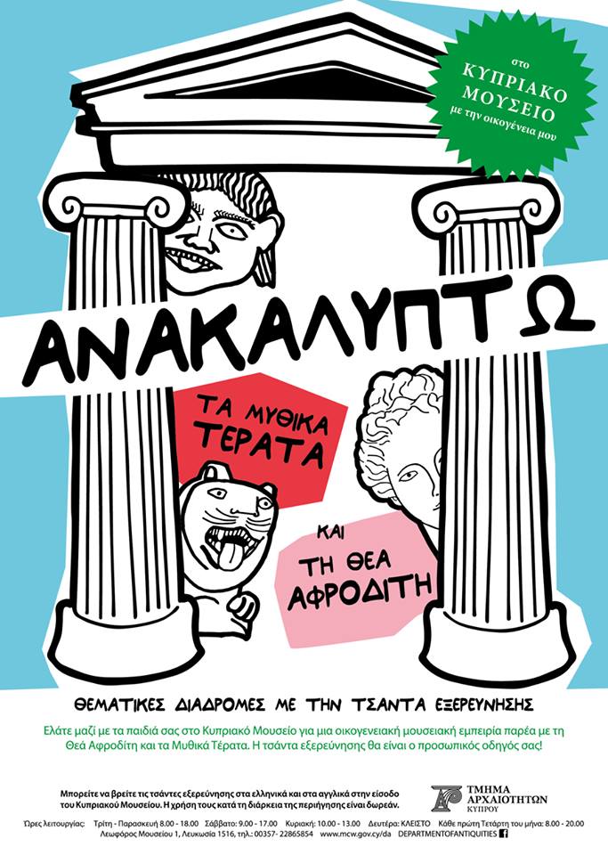
Ελληνικά
Logo of the Republic of Cyprus Department of Antiquities title=

Home Page |FAQ | Site Map | Links | Contact Us
Search:  
Search
Advanced Search         

Excavations

Ελληνικά
PrintPrint


DEPARTMENT OF ANTIQUITIES: EXCAVATIONS

1. Idalion, 2010

(Site Director: Dr. M. Hadjicosti)


The Ministry of Communications and Works (Department of Antiquities) announces the completion of the twentieth excavation season of the Department of Antiquities’ systematic excavations at the site of ancient Idalion. Excavations at the site began in 1991 and continue until today, under the direction of the Director of the Department of Antiquities, Dr. Maria Hadjicosti who is assisted by Senior Technicians S. Lagos and K. Kapitanis. Five young archaeologists from Greek Universities and the University of Cyprus also took part in the excavation this year.

Throughout the twenty-year investigations, a total area of two thousand square meters has been investigated on the foothills of Ampileri hill, which was the west acropolis of ancient Idalion.

In this area, a large-scale fortified building complex has been excavated, which could be interpreted as the Palace of ancient Idalion or its Administrative Center. This building complex contains a triple olive-press (unique in its kind throughout the eastern Mediterranean), roads that lead to the complexes’ courtyards from the external gate, towers and impressive storage buildings, houses and military installations.

The Idalion fort is considered to be the largest palace or administrative center identified so far in Cyprus. It is strictly defensive in character with interior towers that control the interior streets and the large rectangular courtyards. Wings with two-storey rooms surrounded the courtyards,. The ground floor rooms had storage areas were large storage vessels were kept (pithoi) for the storage of wine and olive oil, the area’s main products. Inscriptions, that record tax collecting in kind from the ancient city’s inhabitants, have been found in many of these storage rooms.

The abovementioned inscriptions (more than three hundred have so far been found), are part of the Phoenician Archive and indicate the methods used for the collection of taxes by the Phoenicians, who governed the ancient city of Idalion for 150 years, from the middle of the 5th century until the end of the 4th century B.C. The inscriptions are written in ink on marble slabs and pottery sherds.

During this year’s excavations, the investigations extended higher up the hill, where two new building complexes were discovered. These complexes are attached to the eastern and western side of a large interior tower. The complex situated to the east of the tower constitutes the south wing of the storage rooms’ large courtyard. The rooms’ walls survive to a maximum height of three meters. Inside the rooms, pithoi were found as well as other large vessels, inscriptions, and pieces of a bronze shield along with other metal weapons that had fallen from the second floor when it collapsed. The second building complex was found to the west of the large tower and it is also comprised of six rooms which are linked up to each other and that also communicate with the two large roads to the north and the west. The complex may have been used by the soldiers who guarded the tower.

With the completion of this year’s investigations, the archaeological site has extended to such an extent that it is now ready to be open to the public. The necessary plans are being prepared in cooperation with the Municipality of Idalion. The archaeological site will thus be joined with the Local Museum of Ancient Idalion, which opened to the public in 2008. The footpath that links the museum to the site as well as the parking space near the museum have both been completed. All the above works were realized in close cooperation with the Municipality of Idalion, which has performed exemplary work as far as the promotion of the area’s cultural heritage is concerned.

Ancient Idalion: Excavations


2. Kolossi: Medieval Sugar Mill , 2008

(Site Director: Dr. M. Solomidou- Ieronymidou)


The remains of a sugar-cane factory are situated to the east of Kolossi Castle. Sugarcane was cultivated in large plantations in the area. The installations date to the 14th century and consist of three main areas and other auxiliary spaces. The main building is the sugar refinery factory which is an oblong stone-built domed room. An inscription in the wall on the south external side of the building informs us that the room was renovated in 1591 when Mourat Pasha was governor of Cyprus. To the north of the room lie the remains of a water mill and an aqueduct.

During 2008 the fifteenth excavation season was completed at the medieval sugar mill of Kolossi in the Limassol District. The excavation, which lasted for a period of four weeks, from the 6th to the 31st of October 2008, was conducted under the direction of the Curator of Antiquities Dr. Marina Solomidou-Ieronymidou, with the assistance of archaeologist Doria Nicolaou and the Technicians M. Makri-Chamberlain and A. Tavelis.

The main goal of this year΄s excavation work was the continuation of the excavations in the area north of the circular construction which was excavated during the previous period of 2007. This is the area which is adjacent to the west side of the aqueduct at a length of approximately 4m. Another target was to determine the south limits of the area under study.

In the south limits of the excavated area a wall was unearthed running east-west. To its north came to light the continuation of the stone-paved floor which was partly unearthed during previous archaeological work. Worth mentioning is the increased quantity of carbon which was found near the floor level, something which will be studied after the completion of the excavation and when the monument will be studied in its integrity. The pottery found has a homogeneity since most of it consists of sherds of the characteristic type of vessels used in the sugar processing and only a small number of sherds of glazed pottery.

Of special interest for this year΄s excavation period was the area to the west of the aqueduct, at the northern limits of the excavated area. An elliptical stone construction came to light, which has a maximum diameter 3m. and in most probability is in connection to the smaller circular structure made of bricks which was unearthed during last year΄s excavation work. This elliptical stone structure is to be found at a higher level, 1m. higher than the floor of the circular structure and seems to sit on the northern sides of this and on a wall which extends also to the north of the circular structure with a direction east-west. It is entirely made of irregular stones without any trace of mortar or of any other binding material. At a later stage, when the elliptical stone-built structure was no more in use, it was decided to fill it up with a fairly hard material, of reddish colour made of small pebbles. In this layer a small number of sugar refinery sherds were found.

Although this stone structure is not entirely unearthed (its northern part is not excavated yet), it is evident that in its middle part and above the pebble layer, there was the concentration of a layer of carbon. The large well-hewn stone (AM 3) which was placed on the eastern limit of the elliptical structure at a distance of 0.15m. from the aqueduct΄s wall, was most probably in connection with a certain use which caused the appearance of these large quantities of carbon. It is too early yet to put forward any further analysis or explanation of this matter.

The presence of the layer of carbon is also connected with the “heap” of the broken sugar vessels, which was found in and above the afore mentioned layer. In this “heap” many broken sugar vessels, cone-vessels and flat-bottomed vases of various sizes, were found, some almost intact. The large number of vessels had created a difference in height at the centre and above the elliptical structure, ranging between 0.35-0.40m.

It is worth mentioning that in the area of this large number of pottery, that is above the circumference of the stone structure and outside, we had “recent” debris of the British period. The standing stone basin which sits on layers of the British period and on the pottery heap, can also be dated to this same period.

During this year’s excavation season we also proceeded with the removal of a later date small wall standing in a Π-shaped form on top of the large rock-cut channel situated immediately to the west of the mill-room and to the east of the circular rock-cut structure of a diameter of 4.20m., which was excavated during the 2006 season. The relation between the large circular structure with the sub-terranean chamber housing the wheel of the mill, is a direct one, since immediately under the Π-shaped wall which was removed, at the east limits of the circular structure, the opening towards the large rock-cut channel leading to the sub-terranean chamber came to light. During the removal of this later wall, a clay smoking-pipe of the Ottoman period was unearthed.

The movable finds, apart from the Ottoman smoking-pipe, consisted mainly of fragments of the characteristic sugar vessels, two almost intact (one cone vessel and one flat-bottomed vessel) and one small metallic object with a decorated braid probably belonging to a handle.


Kolossi: Medieval Sugar Mill


3. The Hill of Agios Georgios (PA.SY.D.Y.), Lefkosia

(Site Director: Dr. D. Pilides)


The 14th excavation season, which began on May 22 and lasted until July 7 2006, was the last excavation season at the Hill of Agios Georgios (PA.SY.D.Y),the proposed site for the new building of the House of Representatives.

Apart from a very fragmentary stone structure which may be assigned to the Late Chalcolithic period, found on the south-west slope, where the deeper deposits have been preserved, the site is a large settlement of the Hellenistic period, built on a grid plan with parallel roads from East to West at equidistant spaces and a wide central road from North to South across the settlement. In between the roads there are buildings consisting of rectangular rooms of various dimensions with ample evidence for workshop activities. Terracotta, stone and metal were made on the site and weaving was also one of the major activities of the inhabitants. Earlier remains dating to the Archaic and Classical periods were also found, even though the architectural remains from these periods have not been preserved except on the edges of the slope, on account of the nature of the landscape and the rebuilding that took place at the beginning of the Hellenistic period. The cultic material from all the above periods is predominant and strongly points to the presence of a sanctuary, for which most of the products of the workshops were directed. On the north part of the site, remains of several kilns indicate a continuation of the industrial activities into the Christian period, with a possible gap from the late 1st century B.C. to the 4th century A.D. and a series of superimposed church buildings take the history of the site to the beginning of the Venetian period.


The Hill of Agios Georgios (PA.SY.D.Y.), Lefkosia


4. Katalymmata ton Plakoton excavation 2009

(Site Director: Dr. E. Procopiou)


The Ministry of Communications and Works, Department of Antiquities, announces the completion of the third season of systematic excavations (12.10-20.11.2009), conducted at the site of Katalymmata ton Plakoton, of the Akrotiri peninsula, under the directions of the Senior Archaeological officer of the Department, Dr. Eleni Procopiou. The research is supported by the Akrotiri village Board and the Environmental Department of the British Sovereign Base. The whole project was assisted by Mrs. Mary Chamberlain, technician/ draughtswoman of the Department of Antiquities in Nicosia and the conservation team of the Department of Antiquities in Limassol (Supervisor: El. Charalambous , members: Chr. Orfanou, M. Triantafyllidou, P Panayi).

The project provides archaeological expertise to postgraduade students and researchers through the Graduate European Archaeological Skills Exchange (GrEASE), Leonardo da Vinci program. The 2008 team included Leslie McEwan, Thomas Stewart, David Walsh, Fay Nash, Lucy Asworth, Kathryn Heaton, Joanne Kirton and Alexander Matsangou, as well as the PhD Cypriot students, Doria Nicolaou, Rania Michael and Polina Christofi.

During this season the excavation of the rest of the western part of what was most probably the narthex of a very important ecclesiastical building of the end of the 6th or the beginning of the 7th century A.D., which began in 2007, was completed. The narthex has a total length of 14m on an E-W axis and a width of 36m on a N-S axis. It consists of a raised central area which extends to the west and terminates with an apse. On the east of the raised area the stylobates of the aisles of the central nave, have been found. The remainder of the nave has not yet been excavated. It has been established that this area communicates with the pulpit (ambo) and the Holy Bema to the East by means of a narrow corridor (solea) along the axis of the central aisle. The arrangement of the central raised area allows its identification with a mitatorium, that is to say the area used by the clergy during the certain parts of the liturgies held at that period in the narthex. On the North and South of the mitatorium there are two transepts, 14m.in length on a N-S axis with columns on the interior arranged in Π- shape. On the West and North sides small funerary apses were found of a diameter of 2.25m.

On the South apse there was a larnax that contained an undisturbed burial of an aged individual, its lid decorated with a cross in relief and a perforation for libations in the centre. The burial contained two bronze fibulae for securing the clothing, five coins and burnt organic beads possibly from a prayer bead. On the East side of the same transept there was, in place of an apse, a small conch of rectangular plan, in which the small marble ossuary found last year close to that area, was located. The roof of the nave and the transepts was vaulted and the central arch was supported by three strainers.

The entire excavated area was laid with mosaic floors in 26 different patterns and 24 motifs, mainly geometric. There is only one pictorial mosaic composition on the raised area in front of the central western apse, representing two deer, in front of each side of a vessel, with a rich flourishing tendril, symbolizing Jesus Christ. In the geometric compositions, the main motif is the cross and the symbols of the reign of Solomon (Solomon’s knot and the shield of David).

The building was destroyed by a severe earthquake in the middle of the 7th century. The finds include many architectural fragments and revetments of Proconnesian marble, small marble fragments from an opus sectilae crustae wall decoration and wall mosaics, mainly of gilt glass, glass and mother of pearl. There are also, amongst the finds, many bronze brackets used for securing the revetments, iron nails, fragmentary marble offering tables, glass fragments from windows and glass oil lamps found in front of the funerary apses and in the conch where the relinquary was placed.

It is clear from the above evidence that the building was planned and executed with great care from bishops with a deep knowledge of the religious rites and by the most skilled builders of the island or the empire, so as to honour those buried within it, who must have been very important but their memory, for some unknown reason, was not preserved in the tradition of the area.


Katalymmata ton Plakotonexcavation, 2009: The south transept


5. Palaion Demarcheion, Lefkosia (Site Director: Y. Violaris)


The first excavation period at the site of the Palaion Demarcheion was in June 2002 and excavation continues to this day. This large excavation site in the heart of Lefkosia's (Nicosia's) walled old town has revealed important information concerning the capital's history from the 11th century A.D. up until the 19th century A.D; in other words from the middle Byzantine period until the British colonial period. More specifically, a large section of the Byzantine and Medieval town has been excavated, including two churches, the remains of monumental buildings, workshops, roads, wells etc. There is also evidence for human presence during the Middle Bronze Age period. The large number of moveable finds, mainly dating to the Byzantine and the Medieval period, present a rather clear picture of everyday life in the capital but also of Lefkosia's commercial relations with other parts of the island and abroad.


Palaion Demarcheion, Lefkosia: Excavations


6. Erimi Pitharka, 2008

(Site Director: Dr. E. Procopiou)


The Ministry of Communications and Works announces the completion of the excavation at Cave 1, at the site of Erimi – Pitharka. The exavation was conducted as part of the inter-regional programme, entitled Ellinokamara Kasou – Erimi Pitharka (Interreg IIIA), from the 10th.12.2007 to the 25th.01.2008, and between the 20th and 21st.04.2008. It is co-funded by the European Treasury of Regional Development and the Deaprtment of Antiquities, and the total amount is € 225.000. Apart from the excavation, the project includes the study and conduct of restoration work, as well as site protection and development. The excavation was conducted by contract archaeologist Dr. Anthi Kaldeli, while organisation was regulated by the Project co-ordinator, Dr. Eleni Prokopiou, Senior Archaeological officer. After the completion of the excavation, the cave was drawn by Mr. Costas Tsaggaris and Mr. Panikos Kakkouras.

The aim of the research was the completion of the excavation of all the chambers of the cave. Stratigraphic analysis was central in research, as it provided invaluable evidence for dating the various chronological phases of the cave. Excavation resulted in the recovery of more constructions in the chambers, such as benches, two hearths, and a curved stone wall, which comprises part of a built antechamber. Moreover, excavation revealed stones, which formed part of circular bases, as well as pavings with stones, probably associated with the conduct of work. Parts of the floor were intentionally covered with mud. The most important identification is an oval construction, with intense traces of firing in the interior and ventilation holes at the lower part. This evidence suggests the identification of a basis, possibly of a kiln, associated with ceramic production. Traces of firing were identified throughout the cave.

Finds also included decorated wares of the Late Bronze Age, and a great number of lithic tools. However, the great amount of fragments of pithoi and storage jars, as well as the identification of burnt clay and a number of possible pithoi wasters, provide supporting evidence concerning the probable role of the cave as a ceramic production centre. Albeit a possibility, it is of great importance, as Cypriot pithoi and storage jars were very popular in the Mycenean period. Despite the association of possible production centres, none have to date been archaeologically identified. The issue will be elucidated further by archaeometric and petrographic analyses. The confirmation of this hypothesis will demonstrate once more the historical value of local toponyms, as the area bears the name Pitharka.


.................................................


UNIVERSITY OF CYPRUS: EXCAVATIONS

1. Geroskipou, 'Agioi Pente' (Site Director: Dr. D. Michaelides)


Important early Christian remains came to light in November 2002, during road works at the locality 'Agioi Pente' north of Geroskipou. In the summer of 2003, after a brief rescue operation by the Department of Antiquities, the same Department and the Municipality of Geroskipou invited the University of Cyprus to undertake the excavation and publication of the site. Unfortunately, the basilica that once dominated the site has been almost completely destroyed during the recent activities in the area. However, the variety and quality of imported marble (columns, offering tables) and the fragments of wall decoration (champlevé reliefs, mosaics, frescoes) reflect an exceptionally luxurious building. There are also remains of a burial complex, directly associated with the basilica, with monumental tombs and large ossuaries which, although looted, yielded rich finds: coins, bronze and bone fittings, gold jewellery and other. Two intact mosaics and hundreds of fragments of others demonstrate that at least some of these burials were covered by mosaic floors – something that is witnessed for the first time in Cyprus. The buildings and burials date from the period between the 5th and the 6th centuries A.D.


Geroskepou, "Ayioi Pente": Excavations


2. Palaipafos: The Urban Landscape Project (Project Director: Dr. M. Iacovou)


Palaipafos-Marchello 2006
An Archaeological Research Unit Excavation Project, University of Cyprus

The Ministry of Communications and Works, Department of Antiquities announces the completion of the first excavation season at Palaipafos-Marchello under the director of the Prof. Maria Iakovou. The excavation on the northern side of the Marchello plateau is the first part of a larger archaeological project that aspires to reconstruct the urban landscape of Palaipafos. Old Pafos was founded in the Late Bronze Age, became the economic and administrative centre of an urban polity no later than the 14th century BC and served as the capital of an Iron Age kingdom in the first millennium BC.

The Marchello field project is build upon the Digitised Archaeological Atlas pilot project and the results of the geophysical survey project, which were conducted at Palaipafos in 2002 and 2003 by the joint teams of the University of Cyprus Archaeological Research Unit and the Institute for Mediterranean Studies of the Foundation of Research and Technology of Greece. The new digging project is carried out by Cypriote graduate students of the Universities of Cyprus, Dublin, London, Oxford and Bryn Mawr (USA), as well as Greek students of the Universities of Athens and Crete who specialise in the application of Geographical Information Systems in archaeology. The project was designed and is directed by Maria Iacovou, Associate Professor of Archaeology in the University of Cyprus.

Analysis of the ceramic material recovered during the first excavation season supports the following preliminary results: The site was originally used in the Late Bronze Age for burials. This is made evident by a large number of diagnostic sherds of the White Slip and Base Ring wares as well as sherds of the White Painted Wheelmade III type, which dates to the 13th and 12th centuries B.C. The recovery of two complete vessels (a feeding bottle and a shallow bowl) confirms that the Late Cypriote material represents the residue of burial assemblages.

In the 11th c. there was a drastic change in the use of the site as burials were moved further away to the NW (localities Xerolimni and Xylinos). Walls uncovered during the 2006 excavation season date to the first millennium B.C. when Marchello was gradually incorporated into the Iron Age urban fabric of Palaipafos. On the evidence of pottery this new cultural horizon lasted from the Geometric to the Classical period. The absence of Hellenistic and Roman period diagnostic pottery is critical. It suggests that by the end of the Cypro-Classical period the area of Marchello may have lost its urban significance. This indicates that the urban structure of Palaipafos began to shrink probably as a result of Nicocles´s decision to move the capital of his kingdom to Nea Pafos in the late 4th century B.C.

The most important find of the first season is a street, 1,5m wide, made of thick and well-preserved white lime on a foundation of stones, which appears to descend from the Marchello hill towards the modern-day village of Kouklia. Its investigation may provide an answer as to the route, which linked the natural citadel of Marchello (at 115 meters above sea level) with the sanctuary of the Cypriot Goddess (Aphrodite) to the west (at 80m above sea level).


Palaepaphos: The Urban Landscape Project


    Palaipafos-Marchello 2007
    An Archaeological Research Unit Excavation Project, University of Cyprus
    The Ministry of Communications and Works , Department of Antiquities announces that new data on the history of the ancient kingdom of Paphos are forthcoming as a result of the archaeological field project conducted by the Archaeological Research Unit of the University of Cyprus at Kouklia-Palaepaphos since last year. Designed and directed by Maria Iacovou, Associate Professor of Archaeology in the University of Cyprus, the project’s main target is to reconstruct the urban topography of Palaepaphos through the identification of the ancient settlement’s main components. In the Late Bronze Age, ancient Paphos was the administrative and economic centre responsible for the construction of the megalithic sanctuary of the Cypriote Aphrodite at the end of the 13th century BC. In the Iron Age, the kings of Paphos retained responsibility for the upkeep and function of the sanctuary, and thus had the unusual privilege of being the goddess’s priests, until the very end of the 4th century BC when the institution of Cypriot kingship was finally abolished by Ptolemy I.


    The University of Cyprus team has been working on the northern side of the Palaepaphos-Marchello plateau since last year. The 2007 excavation team, consisting of fifteen Cypriot graduate and undergraduate students of archaeology, a student from the Erasmus exchange programme, plus two British volunteers, exposed 40 metres of the stone foundation of a monumental Iron Age defensive system, 3,5 m. in thickness. They have also uncovered a gate (so far, one side of it only), impressively constructed of finely dressed ashlar blocks, which is protected by a bastion. A general survey of the plateau as well as various construction details - the position of casemates on the inner side of the wall and that of buttresses on the external façade - suggest that the defence scheme was designed to follow and strengthen the natural contours of the hill-top in the manner of a citadel wall.

    Analysis of the ceramic material recovered during the 2006 and 2007 seasons indicates that the site was originally used for the construction of Late Bronze Age chamber tombs. Sometime in the 11th century, when burial sites throughout Cyprus begin to be strictly separated from habitation sites, Marchello ceased to be a burial ground and it was gradually incorporated into the Iron Age urban fabric of Palaepaphos. On the evidence of pottery, this new cultural horizon lasted from the Geometric to the end of the Classical period.

    By virtue of the fact that it commands the highest elevation in the landscape of Palaepaphos, it is more than likely that the hill of Marchello was chosen to fulfil a special function. This hypothesis is supported by the fact that, back in the 1950s, a large deposit of Greek syllabic inscriptions (some of them bearing the names of Paphian kings) and statues (some of them undoubtedly of royal individuals) were found buried on the north side of a monumental and well preserved stretch of wall with a gate, which were then excavated in the 1960s. The recently (2007) exposed stretch of wall with a gate has now been shown to be part of the same system of defence. A geophysical survey and another excavation season in May 2008 are expected to provide definitive evidence in favour, or against, the identification of Marchello as a walled royal citadel of the Archaic and Classical kingdom of Paphos.

    The Archaeological Research Unit wishes to thank the Director, the Curators and the staff of the Department of Antiquities with whose collaboration the University was enabled to launch a successful field project. The 2007 excavation team wishes to thank the mayor and the municipal council of Kouklia for their steadfast support and hospitality.


    FOREIGN ARCHAEOLOGICAL MISSIONS: REPORTS


    1.Geronisos Island excavation- New York University (2009)


    (Dir.: Dr. J. B. Connelly)

    The Ministry of Communications and Works, Department of Antiquities, announces the completion of the New York University Geronisos Island Excavations, under the direction of Professor Joan Breton Connelly, on Geronisos Island, just off the coast of Agios Georgios tis Pegeias, Pafos District.

    The team of 18 excavators began work on May 16, focusing their efforts in the Central Sector of the island where they opened seven 1.5m X 5m trenches along a diagonal axis extending from southwest to northeast. In the southernmost trench, at the very edge of the island, numerous fragments of very large pithoi were unearthed. One of these could be mended to stand to a complete profile of 1.20m in height. The walls of the pithos measure as thick as 0.05m. The pithoi, which were most probably used to hold olive oil, can be placed in the 1st century B.C and according to the excavators, they are among the largest storage vessels found to date on Cyprus. The area from which the pithoi fragments were removed appears to have been a storeroom or pantry facility, probably servicing the complex of small dining rooms found just to the west of this area in previous seasons. The discovery of this storage facility represents an important breakthrough in our understanding of the experience of ancient pilgrims on Geronisos and the ritual dining that seems to have taken place within the complex of rooms in the Central South Sector.

    A number of broken architectural members were also recovered from this season, including what may be the remains of a stone lion’s head waterspout very similar to one that was unearthed on Geronisos in 1994. Traces of the lion’s sculptured mane are preserved along with the moulding of what appears to be a cornice or gutter. This find gives further evidence for a lavishly decorated building of great importance on the island. The sculptured lion’s head would have been plastered and painted as a fitting adornment for a monumental structure, possibly a temple. Excavations in the Central Sector of the island also produced rich finds from the early Chalcolithic period, ca. 3800 B.C. These include a picrolite bead in a “figure eight” dsign, ground stone tools including a small axe and chisel, as well as quantities of red burnished ware pottery.

    The 2009 seasons on Geronisos included the participation of a number of eminent scholars engaged in the study of material excavated from the island. Dr. Jolanta Mlynarczyk of the University of Warsaw continued her study of the late Hellenistic ceramics of Geronisos, while Dr. Mariusz Burdajewicz of the Warsaw Museum continued his study on the glass finds and prepared drawings of the pottery and architecture. Dr. Richard Anderson, architect of the Agora Excavations in Athens, prepared a new site plan of East Building using a total station laser theodolite. He completed important work on the reconstruction of East Building as the vaulted undercroft of a Christian basilica, most of which has collapsed into the sea with the entire east end of the island. Christos Tsiorgiannis of Cambridge University participated in the excavations and Victoria Grinbaum of University College London began a new study of the Geronisos amphorae.


    2. Polis Chrysochous excavations - Princeton University
    (Dir.: Dr. W. Childs)

    The Department of Antiquities announces the completion of the Princeton University excavation at Polis Chrysochous, the site of the cities of Marion and Arsinoe. Excavation was concentrated at the northern edge of the village in an area once occupied by the dig house, which was torn down in 2002. The principal focus of this work was a large building about 25 by 35 meters built partly of large blocks of cut limestone alternating with mudbrick sections. Some of the cut stone had been robbed out in later periods, but the south and west sides are largely intact and the walls stand from two to three meters. The building has several unusual traits. First the use of mudbrick walls both between pier-like ashlar sections and mudbrick cross walls between the ashlar “piers” and long rubble walls that frame the ashlar piers on east and west. Second, the building had no perceivable floor. Third, it contained absolutely nothing. Fourth, the upper parts of the building were filled with sand containing decorated Cypriot pottery of the fourth century B.C. Over the top of the building had been built in the late first century B.C. a Roman building of which the only well-preserved part was a large peristyle court paved with concrete, a material found in fragments throughout the later use of the site in the Byzantine period, indicating that concrete was widely used for flooring in the Roman building. The Roman building appears to have been a private villa with an excellent view of the sea.

    The classical ashlar and mudbrick building appears never to have been completed, since the re-used ashlars and mudbrick walls had no trace of a plaster covering to hide the rough materials used in the walls. The plan of the building so far as recovered is symmetrical with an entrance porch on the south, a large central court (no elements of a roof were found) with small side rooms, and probably a long, narrow room at the north. It overlay several small structures of the sixth century B.C., which were preserved only in fragments: part of a thin concrete floor, several sections of mudbrick walls, and a remnant of a rubble wall. These give no clue to the intended function of the later ashlar and mudbrick building, which nevertheless looks very like a sanctuary building similar to the late fifth-century sanctuary uncovered in the area A.H9 and reported on in the RDAC for 1988, though with the reverse orientation. Further study is needed before any but the most hypothetical interpretation is attempted, of which the following is but one of several possibilities: the ashlar and mudbrick building may have been under construction directly before the sack of Marion in 312 B.C. by Ptolemy Soter. The sand fill may have been put in to incorporate the structure into the defense of the city, since it cannot have been far from the rapidly constructed city wall, extensive evidence for which was recovered in the area A.H9 to the east. Further speculation at this point is fruitless.

    Temporary roofing for the impressive mudbrick wall will hopefully preserve these for some time. They stand just short of three meters tall and, with the ashlar “piers” create the most impressive classical building in the area of Polis Chrysochous.

    The only other area excavated this summer was at the very east end of the ancient site on the eastern edge of the plateau known locally as Peristeries. Here the plan of the building fondly referred to as the “Palace” was uncovered further mainly in its southern sector. The evidence gathered in earlier seasons of excavation that the building followed closely the eastern edge of the plateau was confirmed, since the exterior wall running south turns slightly to the west at just the point were the east edge of the plateau jogs slightly westward. Several small rooms were uncovered, all damaged by the bull-dozing of the area in 1999, when an illegal road was in the process of being built until stopped by the excavation’s foreman. It appears probable that these rooms gave off an open courtyard to the west. It is also likely that the sector of the building preserved was a service wing of a large and extremely well-built structure that may have extended far to the west under the recent construction of a new elementary school.

    The Princeton University excavations at Polis Chrysochous are now concluded and a series of study seasons shall ensue to prepare the publications of over twenty seasons of excavation.


    3. French Mission at Amathous Palace (2008)
    (Dir.: Dr. P. Aupert and Dr. T. Petit)

    The Department of Antiquities announces the results of this season´s excavations at Amathous by the French School of Archaeology in Athens, directed by Pierre Aupert. A cistern (cistern 18) was uncovered on the North part of the site, near the Northern city gate a few years ago. It was partly excavated in 2007. This season, the work was resumed by the French team after the restoration of the walls by the Department of Antiquities. The excavation reached a subterranean chamber (2,20 by 1,90m) cut in the hard rock to a depth of 10m. Last year, the filling, which dates from the end of the 7th c. AD was removed. This year excavation reached the level of the fill accumulated during the use of the cistern. This fill contained many vases lost by the users, essentially terracotta jugs, except an intact bronze hydria, which can be dated between the beginning of the Hellenistic period to the 3rd c. AD. These results are very interesting because the cistern is probably to be related to the aqueduct. One may therefore presume that the aqueduct itself belongs to the Hellenistic period. After the marble head of Aphrodite, found a few years ago, the bronze jug is going to enrich the Archaeological Museum of Lemesos.


      4. Southwest Cyprus Maritime Landscape Project

    (Department of Antiquities, Cyprus
    Duncan Howitt-Marshall, Magdalene College, Cambridge
    Centre of Maritime Archaeology, Southampton)


    The Department of Antiquities announces the completion of this year’s underwater survey in the area adjacent to Kouklia-Palaipaphos by a joint team of maritime archaeologists and remote sensing specialists from the Universities of Cambridge and Southampton, and the UK’s National Oceanography Centre. The project came under the direction of doctoral researcher Duncan Howitt-Marshall of Magdalene College, Cambridge, and forms a crucial part of his PhD data set on the maritime cultural landscape of southwest Cyprus. A diver archaeologist from the Cyprus Department of Antiquities was present throughout the survey.

    The area of archaeological significance was first brought to the attention of Duncan Howitt-Marshall in May 2005 by a local spear-fisherman, Dr. Filios Saziedes. During the ensuing summer a collaborative project was set up between the Cyprus Department of Antiquities and the Centre of Maritime Archaeology, Southampton, in order to systematically record the nature and extent of the underwater site. During this first season of fieldwork the team, using a simple method of non-intrusive survey, located an astonishing 120 stone anchors, the second largest collection of such artefacts found to date in the eastern Mediterranean. The precise chronology of the anchors has not yet been fully determined but from the types recorded many could potentially date back to as far as the Bronze Age. The sheer abundance of anchors strongly suggests that this site was an important anchorage in antiquity, and may have served to transport trade items and pilgrims to Palaipaphos and the Sanctuary of Aphrodite from far flung destinations around the Mediterranean world.

    The 2006 survey was split into two distinct phases. The first phase focused on remote sensing and geophysical survey of the seabed using Sidescan sonar, mapping the approaches into Kouklia-Palaipaphos and potential east-west sea lands used by mariners in antiquity. The sophisticated suite of remote sensing equipment was supplied and operated by the UK’s National Oceanography Centre, Europe’s premier marine research institute, and searched for cultural anomalies at depths less than 30m. Members of the archaeological diving team raised a small number of sediment samples from the seabed in order to create the basis of a habit map of the offshore area. This multidisciplinary approach will serve to build up a comprehensive picture of the sub-tidal zone, incorporating archaeology, geology, and marine biology in an attempt to create the first digital archive of an underwater site in Cyprus.

    The second phase of the 2006 fieldwork concentrated on a non-intrusive diver-deployed survey of the site, which mapped the shallow water area using a comprehensive system of swim-lines. During each line all cultural material was position-fixed in situ using a hand-held GPS (Global Positioning System) and a bathymetric profile of the seabed was logged every four seconds using a dive computer. The data from the profiles will be transcribed into a GIS (Geographical Information Systems) program this autumn at the University of Cambridge, creating the initial layer of the digital archive.

    The project team will propose further investigation of the site next year in a bid to date and provenance the abundant array of stone anchors. It is hoped that the study will throw further light on the role of Kouklia-Palaipaphos in the maritime communications networks throughout antiquity.


    5. Kato Pafos - Toumbalos (2008)

    (Dir.: Filippo Giudice)

    The Department of Antiquities announces the completion of the archaeological excavation at Kato Pafos-Toumpallos otherwise known as “Sanctuary of Apollo” or “Garrison’s Camp” by the Italian Mission, under the direction of Prof. Filippo and Giado Giudice, University of Catania.

    The excavations focused: 1) on the area in front of the trench to the SE of the underground temple; 2) on the edge of an area recently expropriated; 3) on the area of the Early Christian domus built on the upper open space east of the underground temple.

    1) Excavations in the large trench between the rectangular room and the smaller room in the rock in front of which a wall made of large blocks was brought to light in 2006, continued. During previous excavations a staircase was found in the trench. This year’s excavation, conducted beyond the investigations made during the 50’s, brought to light a series of blocks that fell in a homogeneous way from west to east, a fact that led us to the hypothesis that the thick stratum of collapsed materials was a result of an earthquake. The block belonged to a wall that constituted the west side of a large room which seems to be part of a new early Christian domus. The domus was built when paganism was abandoned. An important discovery of this year is a wall of the Hellenistic-Roman sanctuary facing west-east on which rest the debris of the domus. The removal of the stratum of collapsed material during following excavations will permit the revealing of the Late Roman building and the dating of the earthquake.

    2) The trench at the edge of the area recently expropriated by the Department of Antiquities was expanded SE of the underground temple and at the exterior of the underground chamber with an apse which was partly explored last year. Last year, in the external area to the NW of the underground temple, remains made of large stone blocks, clearly reused during the Early Christian period, were found. Inside one of these is a kind of small channel, not completely investigated yet, where a lamp and a hoard of more than one hundred copper coins. During this year’s excavations more coins were found of Late Roman date as well as part of a cistern. The cistern was in use until recently as a coin of George VI of England dating in 1944 was found in it.

    3) At the Early Christian domus exploration of the area west of the western perimetric wall continued. The absence of structures during the excavation led to the hypothesis, which only the expansion of the trench will be able to confirm, that there was a road here oriented NS on which the domus was built. Excavation continued down to the level revealing the the presence of bothroi, which have been empty during the Early Christian period: only a bronze hair pin and a spearhead have survived.


    6. Excavations of the Polish Mission and the Department of Antiquities at Kato Pafos, 2009
    (Dir: Prof. H. Meyza)


    The Ministry of Communications and Works (Department of Antiquities) announces that 2009 was the third season during which the Polish Mission undertook excavations at the Kato Pafos Archaeological Site. The excavations were co-financed by the Department of Antiquities and the University of Warsaw. On behalf of the Department of Antiquities, Dr Aggelos Papadopoulos supervised the excavations between the 16th and 19th December 2008 and 9th January until 4th February 2009. Between the 9th of March and the 17th of April Dr Henryk Meyza, assisted by Ms Joanna Michalska, supervised the excavations on behalf of the Polish Mission and from the 29th August until the 3rd of October Dr Henryk Meyza supervised the work. The third season of excavations included the regular excavation of the western part of the so-called Hellenistic House, the conservation (executed by PROP, Krakow) of a cistern situated under courtyard No. 13, as well as the reconstruction of the Nabatean column belonging to the tetrastyle courtyard. The reconstruction was executed by the Department of Antiquities.The most extensive areas that were investigated were: the south-eastern part of the House of Aion, excavated mainly by Dr Papadopoulos and documented by the Polish Mission, and the western part of the Hellenistic House.

    In the House of Aion, four new rooms were identified, including two (No. 41, 42) with severely damaged monochrome mosaics, which were found slightly displaced but preserving their relation to the dividing wall. Another mosaic seems to have been reused in the Late Roman period. Apart from the above, the area seems to have been looted as indicated by the deep modern trenches found.

    Important evidence was revealed in the western part of the Hellenistic House. This area was destroyed by an earthquake not before Adrian’s times and only a fraction of decorated blocks had been removed in antiquity. In courtyard No. 13, an existing impluvium with a tetrastyle portico underwent modifications since a higher wall was built enclosing the basin between the columns, following a final destruction. Surrounding the impluvium many scattered fragments of a small, long integrated entablature measuring ca. 15 m. in length were found. These seem to have belonged to an upper storey (all 4 of its corners have been preserved). Within the pool, parts of the main colonnade’s Doric frieze were found as well as a Roman-baroque cornice with modillons. One of the portico’s columns, with its so-called Nabatean pseudo-Ionic capital was found collapsed (one of its drums was missing) and has been restored.

    The cistern, which was discovered in 2007, may be approached from the north and specifically, from the rooms under the later south enclosure wall of the House of Theseus, by means of a dromos, which at its lower end forms a staircase. The cistern’s well head was found immediately to the north of the impluvium. Within the cistern a well-preserved, ornate spear butt, sauroter, was found. A second cistern was found under the south-western part of the courtyard and it seems to have supplied water to a bath complex extending south and west of the courtyard. This bath complex is still partially excavated and in its southern part it consists of two rooms with hypocaustic floors and a system of heating channels and pipes. The hypocaust was severely looted even at its lower level of terracotta slabs, of which only imprints in the mortar have survived. In a much better condition were preserved the walls and flue channel of the next room, to the north (No. 32), which was probably a praefurnium. This room has not yet been excavated to the level of its floor, which is situated lower than in the surrounding rooms. The thick layer of burnt matter and the presence of a channel which led hot air to the hypocaust floors of Rooms 31 and 27 and to the Roman House room 4, as well as a partly preserved pillar with triple internal tubulature, cut in stone blocks, are the indications of the room’s use as a praefurnium. A similar but possibly reused pillar was found collapsed in the western part of courtyard 13. Further to the west, two other rooms with stone-paved floors were excavated (No. 33 and 28). In these rooms large pieces of floor were found, probably belonging to an upper storey. Excavations in the north-west corner of courtyard 13 revealed another room (no. 34) with a blocked door and the remains of a staircase which lead to an upper floor.

    The most important discoveries of 2009 include: the unearthing of several sections of a long wall running close to the damaged stylobate of the Villa of Theseus’ peristyle southern portico; the discovery of important data related to the early phases of the Hellenistic House, suggesting that parts of the House originally had floors at much deeper levels; the extent of the earlier bathing establishment under the eastern part of the later Villa of Theseus has been confirmed.


    Excavations at Kato Pafos, 2009


    7. Εxcavations of the church of Agios Nikolaos at the Georgian monastery, Gialia, Pafos

    (Dir: Dr. David Mindorashvili)

    The Ministry of Communications and Works (Department of Antiquities) announces the completion of the excavation of the church of Agios Nikolaos in the site of the 10th century Georgian Monastery, at Gialia village in the Pafos District. The excavations, conducted under the direction of Dr. David Mindorashvili, began on the 12th of September and ended on the 8th of October, and were funded by the Georgian National Office for the Conservation of Cultural Heritage. The church was studied from an artistic point of view by George Gagoshidze and the architectural plans were conducted by Tengiz Gabunia.
    Investigations at this site focused on documenting the foundations of the church of Agios Nikolaos, which once belonged to the Monastery. The site was excavated and the phases of the church’s construction needed to be properly defined. The church (11 X 4 m.) was once a two-storey building. The ground floor functioned as a crypt which was roofed with an arch and divided by walls in the areas where burials were made. Four such ‘ossuaries’ have been found so far and inside them the bones of the dead were found spread about irregularly along with a large number of clay vessels. The moveable finds, which mainly consist of bowls, date to various periods between the 12th and 15th centuries A.D. During previous seasons of investigation of the Monastery’s main church, archaeologists could not locate the monks’ cemetery, which was an integral part of the monastic complex. As this year’s investigations have shown, the Monastery’s monks were buried in the ground floor, in the crypt of the church of Agios Nikolaos.

    Due to the areas’ great extent, excavation will continue in 2010. With the completion of the archaeological investigations the monuments will be conserved and safeguarded. A thorough investigation of the church and the moveable finds will highlight the close links between Cyprus and Georgia, concerning both the religious sphere and the cultural-educational one.


    Agios Nikolaos church, Gialia


    8. Excavations at Kalavasos Kokkinoyia (2009)


    (Dir.: Dr. J. Clarke)

    The Department of Antiquities announces the completion of this year’s field season at the Late Neolithic / Early Chalcolithic site, Kalavasos Kokkinoyia by the University of East Anglia, under the direction of Dr. Joanne Clarke. Kokkinogia is situated in farmland, approximately 4 km south of the village of Kalavasos. It is the most southerly of a cluster of sites located around the intersection of the old Lefkosia/Limassol road and the road to the coastal village of Zygi that include the Early Chalcolithic site Kalavasos-Ayious and the multi-period prehistoric site, Kalavasos-Pamboules.

    The April season brought to completion the first phase of excavations by the Kalavasos Prehistoric Project pending publication of excavations at Kokkinogia. Future archaeological research is planned for the multi-period site, Pamboules.

    In recent years excavations at Kokkinogia have uncovered an impressive “chamber and tunnel complex” and a series of individual and inter-joining chambers. The purpose of these underground features remains enigmatic. Many were sealed up following primary use, or were re-used for tasks such as the processing of ochre or storage of objects; their primary use and why they were actually dug cannot be ascertained as most were completely empty.

    In addition to the chamber and tunnel complex and the individual chambers, excavations uncovered a single circular structure, partly sunk into the bedrock, with a central post hole, fire pit and a series of crushed limestone floors. This structure appears to have been associated with at least some of the underground chambers but clearly had a different use.

    Finally, Kokkinogia was used as a burial place. At least six individuals were interred in pits and chambers around the structure. In one shallow pit was found the fully articulated bones of a young female and the long bones of a second individual. In another pit were three fully articulated skeletons, one on top of the other, and in a chamber-like feature were the stacked bones of another individual.


    Kalavasos- Kokkinogia tunnel complex


    9. Excavations at Souskiou - Laona, Lemba Archaeological Research Centre, Cyprus (2010)
    (Dir.: Dr. A. Peltenburg)

    The Ministry of Communications and Works, Department of Antiquities announces the completion of the sixth season of excavation at the Chalcolithic settlement of Soiuskiou-Laona. The field work, which lasted four weeks, from April until May 2010, was conducted by a team from the Lemba Archaeological Research Centre and the University of Edinburgh under the direction of Prof. Edgar Peltenburg. The team has located evidence for the production of cruciform figurines of the type depicted on the Cypriot Euro coin. The evidence comes from a settlement of 3000 BC located at Souskiou near Palaepaphos.

    This is the first time that such detailed information on this subject has come to light in Cyprus. Among the remnants of a house lay the tools for making the figurines together with abundant fragments or chippings from the initial stages of production. These come from pebbles and blocks of raw material which the sculptors obtained, ultimately from the Troodos Mountains. A further production stage is evident from roughouts in which the figures begin to emerge from the parent rock. Also present were nearly finished figurines that were discarded because of imperfections.

    This unique evidence will allow archaeologists to reconstruct the techniques used by the prehistoric artisans and to see how the craft was organised within the Chalcolithic community. It is already clear that the workshop functioned in a building where domestic tasks were also carried out. There were many such houses at Souskiou which must have been a vibrant centre for the production of these iconic images. Eventually it may be possible to establish the characteristics of the Souskiou style and so to source some of the many currently unprovenanced figurines in museums.

    In another part of the settlement, the team investigated a midden comprised of rich economic data (animal bone, ceramics, charcoal, bone needles etc). Normally washed away by erosion, the material here was trapped beneath buildings that were constructed over this ashy dump of food remains. It may have been deposited by temporary visitors to Souskiou before it was formally settled, or belong to upslope buildings which have now eroded away.


    Souskiou Laona: Incised and painted rosette
    with concentric groove around perforated centre.
    Diam. 7.5 cm.


    10. Archaeological investigation at the site of Aspros, Akamas, (2007)

    (Dir.: Dr. P. Flourentzos and Dr. A. Ammerman)

    The Ministry of Communication and Works, Department of Antiquities announces that the underwater survey conducted during the last two weeks at the early archaeological site of Aspros in the Akamas has resulted the discovery of chipped stone tools and ground stone implements in several submerged areas in front of the site, which goes back to the time before 10,000. The new archaeological remains now show that the pre-Neolithic site was originally several times larger than what is observed on land today. The richest area documented by the survey occurs at a depth of 10 meters in the water and in a position100 meter from the present coastline. This is the first time that archaeological material of such an early date (that is, material going back to the time before the Aceramic Neolithic period on the island, which starts around 8,200 cal B.C.) has been recovered in a submerged context off the coast of Cyprus. This represents a major breakthrough in terms of the study of the earliest archaeology of Cyprus and the origins of seafaring in the Mediterranean world.

    Prior to 2004, very little was known about pre-Neolithic sites on the island. The discovery in 2004 of two new early sites, Aspros and Nissi Beach, on coastal formations of aeolianite, began to throw completely new light on the earliest archaeological sites on Cyprus (dating back to 10,500 to 12,500 years ago), when the island was first frequented by seafaring foragers in the Eastern Mediterranean. In the time of the climatic cold snap known as the Younger Dryas (12,800 to 11,600 years ago or 10,800 to 9,600 B.C.), sea level was some 60 to 70 meters lower than it is today. Whole areas of the coast have been submerged by the transgression that occurred at the end of the last ice age and extended into the Holocene (the last 10,000 years when warmer climatic conditions obtained). In short, what we observe on land in terms of the archaeological record when it comes to early sites such as Aspros and Nissi Beach is only the tip of the iceberg. The challenge, of course, is how to find the small chipped stone tools that are resting on the submerged land surface. In fact, no one had ever tried to do this before on Cyprus. We have now shown how this can be done. The implication is that early sites such as Aspros and Nissi Beach were both much larger and much richer than we have previously thought.

    In the case of Aspros, the site now extends for a length of more than 250 meters all along the top of the cliff on the north side of the Aspros River. The investigation of the pre-Neolithic site of Aspros is directed jointly by Albert J. Ammerman, the O’Connor Professor of the Humanities at Colgate University (Hamilton, New York), and Pavlos Flourentzos, the Director of the Department of Antiquities, Cyprus. The underwater survey was carried out by a team of nine divers from the United States and Cyprus. The dive master of the project was Dr. Tim Turnbull of New York City. The lead archaeologist on the dives was Duncan Howitt Marshall. The lithics have been examined by Carole McCartney.


    11 The Pyla-Koutsopetria Archaeological Project (2008)

    (Dir.: Prof. W. Caraher, Prof. R. Scott Moore, Prof. D.K Pettegrew and Dr. M. Hadjicosti)

    The Ministry of Communications and Works (Department of Antiquities) announces that the 7th season of archaeological fieldwork of the Pyla-Koutsopetria Archaeological Project (PKAP) has been completed in the coastal zone of Pyla village near Larnaka. Since 2003 the PKAP team has worked under the direction of William Caraher (University of North Dakota), R. Scott Moore (Indiana University of Pennsylvania) and David K. Pettegrew (Messiah College) and used intensive survey, remote sensing, and soundings to document this rich archaeological landscape. The 2009 field season was the largest and most complex to date with a staff of 30 students and specialists from the US, Canada, the UK and Cyprus.

    Over a 5-week season, the PKAP team opened six small trenches at the sites of Vigla, Koutsopetria, and Kokkinokremos, each designed to test the results of intensive pedestrian survey and remote sensing. The trenches on the prominent coastal height of Vigla produced significant evidence of a Hellenistic (4th – 3rd c. B.C) settlement. AN imposing fortification wall surrounded domestic quarters whose collapsed mudbrick walls sealed valuable ceramic material on the floors. These buildings may have been the houses for mercenary or garrison forces positioned to protect a vulnerable stretch of coastline near the cosmopolitan city of Kition, or perhaps the homes of local residents who had settled in fortified villages during politically unstable times. The soundings on the neighboring coastal ridge of Kokkinokremos revealed two sections of complex perimeter wall dating to the Late Bronze Age. This wall suggests that the site itself was not properly fortified but only ringed with a series of interlocking structures. While these structures would have presented an imposing vista to an attacking foe, the presence of doorways leading through the exterior wall indicates that residents of the Late Bronze Age settlement regarded practical needs over the need for an impregnable defense. The final area of trial trenches was the Early Christian basilica at Koutsopetria. Work near this long-known building sought to unravel the complex history of repair and rebuilding that occurred during the 5th, 6th and 7th centuries A.D. To gather information on the building’s tumultuous life cycle, the soundings focused on an annex room that suffered several incidents of significant damage before its roof and the second storey collapsed under seemingly dramatic circumstances.

    In conjunction with this work, the PKAP team conducted 10 days of geophysical survey with ground penetrating radar in collaboration with Beverly Chiarulli of Archaeological Services Laboratory at Indiana University of Pennsylvania. This work revealed several areas of significant subsurface features.

    The project enjoyed the generous assistance of the Estate Manager of the British Sovereign Area- Dhekelia Garrison, the Larnaka District Archaeological Museum and the Cyprus American Archaeological Research Institute. The 2009 season’s fieldwork was funded by grants from the University of North Dakota, the Institute of Aegean Prehistory, and generous private donors. All field work was completed with the permission of the Director of the Department of Antiquities, Cyprus, Dr Pavlos Flourentzos and with the cooperation of the Curator of Antiquities Dr. Maria Hadjicosti.

    12. Excavations at Kretou Marottou - Ais Yiorkis and Akrotiri - Aetokremnos

    (Dir.: Prof. Alan H. Simmons)

    The Department of Antiquities announces the completion of this year´s excavation season by the University of Nevada, directed by Prof. Alan H. Simmons. This season, the project had four primary objectives, most of them directed at the mid-Cypro PPNB site of Ais Yiorkis, located near Paphos in the foothills of the Troodos. The first three goals were to complete tool coding from Ais Yiorkis, conduct limited ground penetrating radar studies at the site, and to conduct a survey of selected areas around Ais Yiorkis. The final objective was to excavate the limited deposits at the earliest site in Cyprus, Akrotiri-Aetokremnos, which Simmons excavated in the late 1980s and early 1990s.

    All four objectives were successfully completed. All of the over 10,000 tools from Ais Yiorkis have been coded. Eight units, were surveyed covering approximately 100,000 square meters and locating 3 sites. Two of these are directly above Ais Yiorkis and from surface indications appear to be related in time to the Cypro-PPNB. The ground penetrating radar study examined a 10X12 meter area, and initial results suggest considerable sub-surface features. Finally, the last of the remaining portions of 4 1X1 meter units were removed recovering a very large amount of intact hippopotamus bone, as well as other (mainly bird) bone, shell, a few chipped stone artefacts, and a picrolite pendant blank. The site has now been completely excavated, except for a few remaining pockets in the back of the shelter.


    13. Excavations at Politiko – Troullia (2010)

    (Dir.: Dr. S. Falconer and Dr. P. Fall)

    The Ministry of Communications and Works, Department of Antiquities, announces the completion of the 2010 archaeological investigations at the Bronze Age community of Politiko-Troullia, lying about 25 km southwest of Nicosia near Ayios Irakleidios Monastery in the copper-bearing foothills of the Troodos Mountains. The excavations were conducted under the direction of Dr. Steven Falconer and Dr. Patricia Fall of Arizona State University.

    This year’s fieldwork revealed extensive evidence of the Bronze Age community (ca. 2000-1500 B.C.) that was the predecessor of ancient Tamassos, the seat of a centrally important kingdom during the subsequent Iron Age. These excavations brought to light a series of households around a large communal courtyard that produced evidence of intensive animal husbandry and crop processing, copper metallurgy and sophisticated ceramic technology during the Middle Bronze Age, just prior to the advent of cities on Late Bronze Age Cyprus. The archaeological deposits at Politiko-Troullia reach depths of up to four metres below the modern surface, making this site one of the deepest stratified sites on the island of Cyprus. Archaeological survey of the local landscape shows that the hills around Politiko-Troullia have been terraced and managed intensively for centuries, perhaps beginning as early as the Bronze Age. The ancient villagers of Politiko-Troullia cultivated grapes and olives, and herded sheep, goats, cattle and pigs. They also hunted considerable numbers of deer and wild goat.

    The results from Politiko-Troullia open an archaeological window on the farming and mining communities that provided the foundation for urbanized civilization on Cyprus. Drs. Falconer and Fall are particularly grateful for all the kind support, encouragement and friendship offered to their project by the people of Pera (Orinis) and Politiko, most especially by mayors Costas Miliotis and Andreas Voskaris. The Arizona State excavations at Politiko-Troullia hope to provide a new understanding of the earliest history of Pera, Politiko and their neighboring modern villages.


    Politiko Troullia, 2010


    14. Eastern Cyprus Maritime Survey, 2009

    (Dir.: J. Leidwanger)

    The Ministry of Communications and Works, Department of Antiquities, announces the completion of an underwater diving survey campaign that was undertaken from mid-July to mid-August along the island’s southeast coast in the area of Cape Greco. The project is sponsored by the Institute of Nautical Archaeology at Texas A&M University, with financial support from the University of Pennsylvania and RPM Nautical Foundation, as well as additional logistical support from the Thetis Foundation.

    The project focused on the site of a Roman shipwreck discovered in 2007, completing a non-intrusive preliminary map of surface remains to determine the extent of the site, its preservation, as well as the full character and composition of the cargo. The ship, dating to the first decades of the 2nd century AD, appears to have been carrying a mixed cargo of liquids, likely wine but perhaps also oil, in over 130 ceramic jars, or amphoras.

    Most of the assemblage is composed of jars from southeastern Asia Minor and the general northeast Mediterranean region. Another group of amphoras, however, appears to have contained wine imported from the Mediterranean coast of France. A few non-cargo items discovered on the site were likely used for storage and preparation of food, and may point to a galley and give clues to life onboard the merchant vessel, although no wood, anchor, or other ship fittings are visible on the surface scatter. Where the ship was heading remains unclear, but its location in shallow waters, and the Roman presence in the area of Cape Greco and further north at sites like Lefkolla, suggest that either the vessel was nearing an intended port-of-call, or else was engaged in a coasting trade, moving products to market over short distances up and down the coast. Though scattered, the remains provide significant insight into the local, regional, and even long-distance commercial connections of this peaceful but prosperous Roman island.

    Plans for future work in the area include a full shallow-water survey in the Cape Greco area, combined with a remote sensing search for better preserved sites in the deeper sandy seabed farther offshore. The Cape Greco area’s prominent maritime history is testified not only by the shipwrecks, anchors, and other finds recorded so far along the coast, but also by reports from local divers and specific events in the historical record. According to Diodoros, it was at somewhere just north of here that in 306 B.C. the Macedonian Demetrios Poliorketes triumphed over Ptolemy of Egypt in one of the largest naval engagements of antiquity. Although Ptolemy eventually returned, proved victorious, and controlled the island through the rest of the Hellenistic period, nearly one hundred warships reported as sunk during the combat provide another hopeful target for archaeologists working in deeper waters offshore.


    Divers record the Roman shipwreck's remains
    near one end of the scattered site.


    15. Excavations at Choirokoitia, 2008

    (Dir: Dr. A. Le Brun)

    The Ministry of Communications and Works, Department of Antiquities, announces the completion of the archaeological excavation at the Neolithic site of Choirokoitia. Excavations were carried out in July and August by the National Centre of Scientific Research of France under the direction of Dr A. Le Brun.

    Research undertaken in 2005 on the north side of the hill where the site is situated was completed. The aim of this research was to determine the outline of the walls, which constituted the successive boundaries of the settlement. The results obtained, have in many points, profoundly altered our view of the site of Choirokoitia and, more widely, our knowledge on the recent phase of the Neolithic Aceramic period of Cyprus.

    The research of previous years has shown that the expansion of the built area on the south side occurred simultaneously with the abandonment of the north side. Therefore, the history of the settlement needed to be reconsidered: it must be interpreted as a rearrangement of the built environment rather than the expansion of the village. This year’s archaeological campaign contested the idea that we had until now concerning the way in which the developed in the area. The wall, which constitutes the primary limit of the establishment, was found in a deep trench near the river. Initially it was thought that the course of the wall was perpendicular to the flow of the river thus completing the natural protection of the river where it was absent. The new evidence has shown that the wall follows a parallel course to the Maroni river-bed. Therefore, the village has to be viewed differently, as a village enclosed by a wall made of massive pisé with its exterior façade revetted in stone. The elevation of such a construction at such a length expresses a collective effort which presupposes a well- structured social organization.


    16. Excavations at the North Hall of the Sanctuary of Aphrodite
    during the season 2007

    The Department of Antiquities announces the completion of this season´s excavations at the Sanctuary of Aphrodite at Palaipaphos which was first investigated by the Cyprus Exploration Fund in 1888 and excavated systematically by the Swiss-German Archaeological Expedition in 1973–79 and 1993–95. Only the extreme northeast corner of the building complex, covered by a 19th century village house, had remained inaccessible. Part of this structure was removed recently, and on the request of the Department of Antiquities the area was excavated in late September and early October.

    The North Hall marks the northern confines of the Sanctuary. Like the South Stoa, it served as cultic banqueting hall - a type of building developed from the original Greek banqueting hall by substituting continuous platforms for the individual stone-built klinai. The worshippers rested during meals on a raised podium which enclosed a mosaic pavement, decorated with a geometric pattern. We were able to recover to a large extent the foundations of the eastern and northern outer walls as well as of the eastern and northern podium walls, and thus to complete the plan of the North Hall. It extended over the entire width of the Sanctuary site, covering a space of 62.5 by 12.5 m. At the same time, further 26 square metres of the mosaic pavement, in a fairly good condition, could be uncovered.

    From the point of view of earlier work in the Sanctuary, these results were in a way predictable. Unexpected were discoveries made while excavating the podium walls. Here architectural fragments were reused in the foundations as building material, comprising beside Doric limestone columns elements of a very unusual votive monument resembling features of Nabataean architecture from Petra and other sites. The structures of the Roman sanctuary surviving today were erected during the late 1st or early 2nd century AD. These new finds point to the existence of earlier buildings on the site, dating from the late Hellenistic or early Roman period. At the same time they testify to influences of Near Eastern art which may present an interesting prospect of further research.


    The northeast corner of the North Hall, with column drums
    and other spoliae built into the podium wall


    17. Excavations on Fabrika Hill (Kato Pafos) (2008)

    (Dir.: Dr. Claire Balandier)

    With the permission of the Department of Antiquities of Cyprus, a French archaeological expedition, directed by Dr. Claire Balandier, Professor. of Ancient History and Archaeology at the University of Avignon (France), conducted excavations on Fabrika Hill from April 15th to May 9th 2008 with financial support from the French Ministry of Foreign Affairs.

    The main aim during the first season was to try to trace the ancient city-wall of Nea Pafos in its North-Eastern part, where it is still unknown. During a field-survey on the top of the hill some blocks were located in situ in the area's northern part, directly below the northern edge of the hill, close to Daedalus street. The excavation revealed that these blocks belonged to a wall which runs at least 20 meters towards the North.

    A sounding made behind the wall has shown that it had not been built with two faces: it was built with one face against the rock with a filling of rubble stones. The face of the wall is made of ashlar blocks, probably reused. A sounding was made against the face of the wall: its foundation reaches a depth of 3 meters. It is built on a mass of huge rubble blocks. The rock has not been reached yet. The stratigraphy shows that this wall was built at the very end of the Hellenistic period or at the beginning of the Roman period. One should be able to be more precise about the date next year.

    On the Eastern part of the hill, north of the theatre, we observed that there is a gap in the rocky cliff where a footpath reaches the top of the hill. At this point we looked for the position of a possible north-east gate of the ancient Pafos. No evidence of a gate has been found yet but different walls and levels have been uncovered. A wall has been uncovered running parallel to the edge of the hill. It is preserved only at a hight of 0,50 m but one can see that it was very well built with ashlar blocks, very carefully cut, and a thick layer of lime mortar. We do not know yet what purpose this wall served and to which building it belonged. After its destruction, it was used as a foundation for a later building, also ruined. The ceramic finds are mainly dated to the medieval period and more precisely to the Frankish period. A nice seal, belonging to Gerardus, bishop of Bologna, was found, perhaps from the 13th century. All the artefacts found in the area lead us to believe that during the medieval period an important building existed on this part of Fabrika hill, perhaps a church. We should have more evidence of the use of this building next year.

    A clearing of the rock on the western part of Fabrika hill, near Apostolos Pavlos street has been made where some steps were visible on the rocky cliff. A sounding at the foot of the cliff has shown that it was not steps but the results of quarrying. A very modest house or sheep shelter has been built against the cliff, probably at the Ottoman period, as shown by a fragment of pipe. We did not find any evidence of the city wall in this area.

    Next year, the 2nd season of the French Archaeological Expedition at Pafos will try to precise first the trace of the city wall on the northern part of Fabrika hill and then the function of the medieval building on the eastern part of the hill and to get more precision on the chronological datas.


    18. Excavations at Kissonerga-Skalia 2009

    (Dir: Dr Lindy Crewe)

    The Ministry of Communications and Works, Department of Antiquities, announces the completion of the third season of excavations at the Early–Middle Bronze Age settlement of Kissonerga-Skalia. The excavations were carried out by a team from the University of Manchester, under the directorship of Dr Lindy Crewe.

    The area around the village of Kissonerga near Paphos is rich in prehistoric remains. The area was occupied from the earliest Neolithic of Cyprus and also housed an important Chalcolithic settlement. We can now extend the prehistoric occupation of Kissonerga into the Bronze Age (c. 2400–1650 BC), with evidence in the locality now spanning over 6,000 years.

    The team’s goals this season were to further expose the Bronze Age architecture revealed in the first two years. A large, free-standing, furnace-like structure around 2 x 2.5m in diameter was fully uncovered. The structure had a wide opening and either raised mud plaster walls or a domed roof, perhaps similar in appearance to a traditional village oven (Fig. 1). In the ashy deposits of the base a partially collapsed large storage jar was found embedded upright in a pit with a cooking pot at the bottom. Further excavation is required to establish the nature of the construction and possible function of the structure as it is the only example of its kind from this period.

    In the adjacent trench, floor deposits were excavated in a typical Bronze Age-style rectilinear building (Fig. 2). The lower floor deposit was found overlain with animal bones, edible sea shells, a copper fish hook, storage jars and cooking pots and seems to have had a domestic function. The unusually wide (1.2m) rubble wall that was partially uncovered in the north of the site in 2007–8 was further excavated and a wall measuring around 17m in length was exposed. On the interior of the wall a floor surface was uncovered with plastered pits, spreads of pot sherds and ground stone tools. On the exterior a paved surface embedded with pebbles and pottery and an additional enigmatic stone built feature was found. This represents the latest preserved occupation in this area of the settlement and is dated by the pottery to the very beginning of the Late Bronze Age, when the site seems to have been abandoned. No subdivisions have as yet been revealed on its interior and the wall’s function remains uncertain.

    The three seasons of excavation undertaken so far have revealed both similarities and differences with other sites of the period elsewhere on the island. Further work is required to fully expose the architectural remains and to explore the nature of occupation at the site. In addition to the preserved architecture, other finds include copper objects, textile production (attested by spindle whorls), and numbers of ground stone objects, including agricultural tools and weights. A piece of copper slag found in 2009 reveals that copper working was carried out and White Painted pottery from the northwest that they had contacts with other parts of Cyprus. Why the occupants of Kissonerga-Skalia chose to live on the coast, in contrast to the usual pattern of inland settlements of the Early–Middle Cypriot Bronze Age, remains unclear. Other research questions to be pursued in future seasons include when exactly the site was founded in the Early Bronze Age and why it was abandoned on the threshold of the Late Bronze Age.


    Excavation at Kissonerga Skalia 2009:Rectilinear building


    19. Excavations of the Aristotle University of Thessaloniki at the ‘Rhoudias’ site in the Troodos Mountains, 2009

    (Dir.: Dr. N. Efstratiou)


    The Ministry of Communications and Works, Department of Antiquities, announces the completion of the 2009 excavations conducted by the Department of History and Archaeology of the Aristotle University of Thessaloniki (AUT) in the Troodos area. In 2008 the project located an important ‘pre’Neolithic’ (as it was preliminarily termed) site of Rhoudias in the south foothills of the Troodos Mountains (470 m elevation), in the district of Pafos. The identification of this site generated not only many research expectations but also demands for the confirmation of the site’s early cultural characteristics.

    In November 2009 a small team from the AUT returned to the site of ‘Rhoudias’ having been granted license from the Department of Antiquities and consent from the Cyprus Forestry Department. The team, which was led by Professor of Prehistoric Archaeology Nikos Efstratiou and included the Cypriot archaeologist-teacher Dimitris Kyriakou and the students Eleni Mloukie, Yiannis Voskos and Elli Tzanne, conducted a short geological and archaeological investigation. This investigation included firstly, an assessment of the site from a geological point of view, secondly, a systematic collection of surface material over a substantial area of the site with the use of a grid system in order to confirm the site’s pre-Neolithic character, thirdly, the opening of small test trenches in various parts of the site in order to record the various archaeological layers and finds (mainly lithics) and finally and most importantly, the collection of samples for radiocarbon dating.

    All three main areas of study in the 2009 investigations were fulfilled in the best of ways. Specifically, the team’s geologist Dr. P. Karkanas confirmed the Pleistocene character of the terrace on which the site is located and its association with the riverbed. He also located the exact initial position of the site and noted the variation of flint sources that exist in the area. Most importantly however, Dr Karkanas located the geological deposits in which archaeological material could be considered to be found undisturbed (in situ). Meanwhile, the systematic collection of surface finds resulted in the accumulation of a numerically rich collection of lithic material. Finally, the small test trenches that were excavated following the methodological ‘protocol’ of a Paleolithic excavation, revealed stratified lithic material (tools, flakes, animal bone, organic residue) within the layers that had been previously indicated by the team’s geologist and that proved to be of a satisfactory depth. The tens of lithic tools that were found and subsequently recorded in ‘stratified’ contexts demonstrate the site’s persistence in time. The site’s size is estimated to be tens of square metres and it is expected that the investigation of the total area of the Pleistocene river terrace, which has been calculated to be over five thousand square metres, will clarify the site’s exact size. With regards to the dating of the site, the organic samples collected and are to be radiocarbon dated are expected to be especially enlightening

    The preliminary study of the lithics available yet comes from the surface reconnaissance material of the site. The Rhoudias assemblage gives the impression of a camping\activity situation with the possibility of a palimpsest seriously considered starting with a significant number of geometric pieces and flake cores, some of which would certainly be at home in the early coastal assemblages and continuing with finely made thin blades involving blade-based core technology, Neolithic in character. Unfortunately finished tools are poorly diagnostic. The local availability of chert outcrops does not seem to point to quarrying activity because of the lack of large number of cores. If we think of a real palimpsest and separate the flake-based and geometric materials from the blade-based tools the possibility for an earlier time designation is stronger. However, it should be strongly emphasized that the character and date of main occupation period of Rhoudias will be clarified only after the stratified material from the site is studied and the radiocarbon dates are available.

    The 2009 survey and excavation results at the site of Rhoudias have been extremely satisfactory and they seem to confirm, at least as far as the nature of the lithics technology is concerned, that the site could be placed in Cyprus’ pre-Neolithic horizon.

    The excavation of the material traces of pre-Neolithic groups of hunter-gatherers of the beginning of the Holocene in Cyprus’ hinterland is considered to be an important step towards the better understanding of the island’s early prehistory and the documentation of the characteristics of these early groups.


    Test trenches at the site of Rhoudias ion the Troodos mountains, 2009


    20. Lycoming College Expedition to Idalion – Lower City (2009)

    (Dir. Dr. P. Gaber)

    The Ministry of Communications and Works, Department of Antiquities, announces the completion of the 2009 excavation season of the Lycoming College Expedition to Idalion under the Direction of Prof. Pamela Gaber. This year’s goals included work in the Lower City South, the temenos that the excavator refers to as the ‘Sanctuary of the Paired Deities’ due to the pair of standing stones in the central chamber containing the altars and ash pits. Efforts were concentrated in the eastern end of the complex where a number of substantial walls were revealed, all in perfectly parallel formation with those discovered in previous seasons.

    The architecture was close to the surface, as in previous seasons, with a layer of mudbrick – often scored with plough marks- above the stone socles. In some cases there were mudbrick structures in situ in conjunction with the stone walls visible. Mudbrick structures are visible particularly in the eastern trenches and most of them date to the late Hellenistic and Roman periods during which it appears that people were using and refurbishing older installations. Thus, a feature in the west of trench ‘E015’ appears to date to the Cypro-Classical period, but some of the installations immediately to its east have had concrete and mudbrick embellishments added later. Immediately to the north of trench ‘E015’ a deep, plaster-lined pit was found. It contained a large quantity of bone, a few terracotta fragments, a limestone sculpture fragment and two Cypro-syllabic inscriptions.
    Perhaps of greatest interest in terms of the longevity of the site’s sacred nature, was the unearthing of a votive deposit in the mudbrick detritus that has been mentioned above. In other words, after the buildings had fallen into ruin, someone found an ancient pot, a terracotta head and a terracotta quadruped (perhaps after breaking into an ancient tomb while ploughing), and remembered that this place was once sacred.
    In addition to the late installations in the eastern end of the temenos, a Cypro-Archaic wall was also unearthed with foundation trenches in the western part of the sanctuary.
    Investigations next season will focus on exposing earlier floors associated with the early architecture of the temenos. The opening of the Hellenistic/Roman villa site uncovered in the 1970’s by the previous excavators is also part of next season’s plans. In addition, the site of the Adonis temenos on the terrace of Mouti tou Avrili, the east Acropolis of Idalion will be reopened.

    21. Kouris Valley Project, 2008


    (Universities of Florence, Chieti and Pescara)

    The Ministry of Communications and Works, Department of Antiquities, announces the results of the 2008 Kouris Valley Project carried out by the Universities of Florence, Chieti and Pescara.

    The results are very interesting and confirm hypotheses that were formulated in the 2007 report, leading to further working proposals for the future. Work on the field, started on September 11th, was concluded on October 4th 2008, and focused on the following:

    1. The survey
      The survey on the western river bank of the Kouris valley was completed. The situation seems to be different from that of the eastern side: the only relevant findings which go back to the Hellenistic/Roman period are confined to two sites located in the low terraces in the southern area of the valley. It is very likely that the morphology of the ground (steep slopes from the dam to the roman terraces) has conditioned a north-south human habitation along this river bank. It is possible that during the second Millennium B.C. the route from Alassa or other settlements on the high course of the Kouris to the coast was along the eastern side of the river. This working proposal will be discussed in length in the future, once further data is available.

      The eastern side of the river was revisited and the presence of a “farm” with an occupation phase dating to the EBA-MBA period was noted, based on the large amount of surface Red-Polished ware. The theory has now been supported by the results of the geophysical survey conducted with a Magnetometer.

      Some tombs of uncertain date have also been identified during this season.

      A sampling of different soils and sediments has been carried out from the whole extent of the valley. Moreover, the fabrics of the different wares collected both during survey and excavation have been identified. This research aims at locating the sources of clays and their chemical/mineralogical composition.

      A further analysis concerns the study of the place-names in the valley with a view towards acquiring a general picture from a linguistic point of view. As a preliminary starting point the name of Alasiya and local toponyms have been sampled.

      2. The archaeological trenches

      This year the excavations were limited to northernmost site which was surveyed last year on the eastern side of the Kouris. Four trenches were sunk out, on the top of the mound and on the two lower terraces. The excavations have revealed the presence of structures dating back to the EBA-MBA period, as confirmed by the ceramic evidence: from all the excavated trenches Red-Polished wares are the most commonly attested within the pottery assemblage. A complex system of a double circuit wall has been identified. A sequence of two phases was revealed: the first one possibly dates back to the Early/Middle Bronze Age, the second (on a quite different circuit) dates to the Hellenistic-Roman period. For the reconstruction of these phases of the circuit wall, both a topographic plan by total station and an aerial photographic documentation have been used.

      A larger trench on the hilltop revealed the presence of a large workshop, possibly intended for the processing of leather or textiles, as could be inferred from a series of inter-connected basins and channels in the bedrock. The spindle-whorls and loom-weights coming from this workshop area also point to this specific activity.

      In a small cemetery area in the third lower terrace, a series of three rock-cut tombs have been excavated. Among the grave-goods found inside two of these tombs, there was a large number of vessels of Red-Polished ware as well as some small objects (decorated spindle-whorls, picrolite ornamental disks). The similarity noted between the funerary finds and the workshop contexts can be interpreted as an attempt to form part of a craftsman’s equipment. The analysis of the skeletal remains has revealed a multiple inhumation of three individuals (a man, a woman and a child) and a single inhumation of a woman.

      22. Archaeological research at Pyrgos Mavrorachi, Lemesos

      The Ministry of Communication and Works (Department of Antiquities) announces the end of the first excavation period at the locality Mavrorachi at Pyrgos, Lemesos, for this year. The archaeological mission of the Italian National Council for Researches in Cyprus, which is excavating there, is co-funded since 1998 by the Italian Ministry of Foreign Affairs, by the Cultural Association Tuscia Cultura, by the Center for Experimental Archaeology “Antiquitates” of Blera Italy and by the Municipality of Pyrgos. Preliminary results are published on the web site www.pyrgos-mavroraki.eu.

      Archaeological excavation has brought to light an architectural complex of about 2000 square meters, which was destroyed by an earthquake around 1800 B.C., at the end of the Middle Bronze Age II. The entire site is calculated by geophysical prospection and GIS systems to 4,000 square meters. In the deepest layers of the excavation, artifacts were found that prove that the site was in use during the earliest phases of the Early Bronze Age (2400-2000 B.C.).

      Of particular importance is the discovery of an industrial zone organized around the production of olive oil. This area was also used for the refining of copper, production of bronzes, extraction of aromatic essences for the preparation of perfumes, dyeing and preparation of plant fibers and animal production, weaving, and composing of pharmaceutical substances. A special room with specific equipment for the preparation of wine, which was also used in therapeutic and aromatic, was found too. The various rooms in which the activities took place were intercommunicating.

      The site is important for its industrial identity and for the intact prehistoric levels, buried by the sudden collapse of the walls after an earthquake. This particular condition allows, through archaeology, archaeometry, paleobotany, paleozoology and etnoarchaeology investigations to reconstruct the second millennium BC processes of metallurgy, agriculture, medicine and textile production.

      In 2008, a second building was discovered and brought to light, to the south of the industrial area. This is a unique construction, consisting of two rooms arranged in a triangular area (12×12×24 meters, 90º/45º/45º). As the nearby building, it was probably destroyed by an earthquake and abandoned around 1800 BC.

      The excavator proposed that this building was a cult site with an altar, which was flanked by a channel on two sides. The channel, which is made of pebbles and it is plastered on the sides, might have served as a channel for the disposal of the blood of the sacrificed animals. A squared pit located on the north side of the altar might have been the source for water used in the rituals.

      According to the excavator, the religious use of the building is deduced by numerous finds (not only ceramics), including four calcarenite horns of different sizes and a number of animal bones, mainly fragments of crania of bull and rams. The triangular structure seems to date to the last reconstruction episode, which according to the ceramic finds dates to Middle Bronze Age II.


      As far as historic parallels are concerned, altars with side channels for the disposal of sacrificial liquids are described in several passages of the Bible, though not in triangular structures. The triangular structure in Pyrgos is unique and it seems to be an enlarged version of a smaller triangular construction positioned in the main building, excavated in the previous years.


      This smaller triangular structure, according to the excavator, could belong to an earlier sanctuary, dating to the Early Bronze Age, as its foundations were found in deeper layers. In the middle of this structure, a large hole encircled by a double line of stones was probably the original location of the pithos jar found in fragments around the altar. Fragments of a second pithos jar were found to the south of the altar, together with a fragmentary four-legged Red Polished bowl of rare shape. A pair of copper earrings of the Philia phase (the earliest phase of Early Bronze Age) was excavated in the deepest layers, together with shell pendants and flat-based vessels, characteristic of the earliest phase of Early Bronze Age. All these suggest that the building is one of the earliest constructions at the site.

      The location of this cult place next to the area where metallurgical activities took place, is connected by the excavator to the later tradition of the Late Bronze Age where cult places are situated next to areas of metallurgical activities (Myrtou Pygades, Kition, Athienou, Enkomi).


      23. Excavation of a stone age water well at Kissonerga, Pafos, May - June 2009

      An infilled shaft revealed by an earth-moving machine on a building site beside the main coastal road at Kissonerga, Pafos was investigated by the Department of Antiquities and Edinburgh University between 7th May and 4th June. The shaft proved to be cylindrical, 75cm. in diameter, and preserved to a depth of 5 meters below the surface of havara bedrock. A number of small niches had been cut into the side of the shaft on the east and the west to accommodate the hands and feet of the people who originally dug the well as they climbed in and out of it. At the base of the shaft were several small natural channels in the bedrock through which water would have flowed, confirming that this was a water well. Water would presumably have been extracted by some sort of bucket, possibly made of leather, on a rope.

      Once the well had gone out of use as a water source, it silted up. During the course of its infilling various items fell into the well, or were deliberately dumped or placed there by people. These items included animal bones (of sheep, goat, pig and fallow deer), worked flint, a few stone beads and pendants, and pieces of broken stone vessels that are typical of the early (aceramic) Neolithic period in Cyprus, before pottery came into use. About half way up the shaft was found the poorly preserved skeleton of a young woman. Unfortunately we shall never known how she came to be there.


      Neolithic water well, Kissonerga, Pafos, 2009


      Towards the base of the well were found an intact small, crude bowl and a dish of much finer quality that had clearly smashed when it fell, or was thrown, in Both were carved from chalk, and were perhaps vessels that had been around the well-head. These and the other finds indicate that this latest well to come to light is of broadly similar date to six other wells that have previously been excavated in the vicinity by a team from the University of Edinburgh. Radiocarbon dates indicate an age of 9,000 to 10,500 years for these wells, placing them amongst the earliest water wells known anywhere in the world.

      24. Excavations at Episkopi Bamboula

      (Dir.: Prof. Gisela Walberg)


      The Ministry of Communications and Works (Department of Antiquities) announces that investigations of Area XVI at Episkopi Bamboula were conducted for three weeks in June 2009, under the direction of Professor Gisela Walberg, University of Cincinnati.

      The aim of the excavation last summer was to define more clearly the nearly 4.80 m wide stone formation (Wall 37) and to extend the excavations in different directions. A considerable part of the area was framed on four sides by walls of an average width of 2.50 m. Also, a passage, which leads up to the rampart by way of two large steps, was discovered to have a hard floor with pebbles set in clay mortar and some fallen stones on the surface.

      This year 27 test trenches were excavated in order for the earlier results to be verified and also in order to see if the combination of walls, spaces and other architectural features show purpose and rational planning. Also, the relations between the large stone structure (Wall 37) and the other walls needed to be clarified. These walls were not likely to be of the same period since Wall 37 divides Area XVI into an eastern and a western half and there are no openings between the two halves.

      The 2009 excavations showed that Wall 37 on the one hand and Walls 53, 47, 56 and 51 on the other, are indeed of a different date. It was made clear that Wall 37 must have been built at a later stage to replace walls enclosing the area at a lower level. Thus, there are walls at two different levels of which four enclose and protect the area on all four sides and the fifth runs in a north-south direction and protects the area in the east, the side of the river Kourris. The level of the passage excavated in 2008 was established to be considerably higher than that of Wall 37 and the passage could therefore be identified as belonging to a later architectural phase.

      During the course of the excavations the ceramics found in strata 6, 7, 8, 9 and 12 are all non-diagnostic. A pithos sherd of the Late Bronze Age turned up this year in stratum 8 of Test Trench 7 and in strata 1-5 the latest sherds were of Roman date. Considering their width, the walls must be of a defensive character. The closest parallel to Walls 53, 47, 56 and 51, from the point of view of plan and architectural technique is the LC I-IIB fortress of Nitovikla on the Karpass peninsula, excavated by the Swedish Cyprus Expedition in 1929.

      Finally three fields were surveyed, one on the Bamboula plateau, south of Area XVI, and two east of the area. The date of the ceramics ranges from the Late Bronze Age to Roman and Medieval times with a higher percentage of Roman and Archaic sherds.

      25. The University of Edinburgh Univeristy excavations ot Prastion-Mesorotsos, 2009


      (Dir.: Dr. Andrew McCarthy)

      The Department of Antiquities announces the completion of the Univeristy of Edinburgh 2009 Prastio-Mesorotsos project that took place from 22 June to 30 July, and involved investigation of the stratified remains of Neolithic, Chalcolithic, Bronze Age, Iron Age, Late Antique and Medieval archaeology. Excavations were carried out in eight areas across the circa 10 hectare site in the Paphos district. In total, over 100m2 were exposed and architecture and features from multiple periods were revealed.

      This first season of excavation has confirmed the presence of deeply stratified (at present 1.5m+) occupation at the site, which may eventually shed light on a series of important social changes that occurred, for instance the transition from the Neolithic into the Chalcolithic period. Particularly encouraging was the presence of Middle Cypriot Bronze Age architecture, which is situated in the same location where Early Cypriot Bronze Age and Late Chalcolithic materials are being found, which could eventually lead to a stratified sequence throughout these important periods. Equally important is the apparent abandonment of the site in the Middle Cypriot III period, which coincides with the burgeoning importance of Palaipaphos (Kouklia) as a regional centre of western Cyprus. Understanding and dating the abandonment of Prastio-Mesorotsos could tell us when and why Palaipaphos came to be such an important place in the Late Bronze Age.

      After the tumultuous end of the Late Bronze Age, the site of Prastio-Mesorotsos was re-occupied in the Iron Age and continued to be the focus of inhabitation and activity until fairly recently, as shown by the excavation of substantial Medieval remains, and a large threshing floor. Continued excavation at the site may provide valuable information on social changes through time, and provide an important perspective on changing ways of life in western Cyprus.


      27. University Of Florence (Universitá degli studi de Firenze) Excavations at Erimi- Laonin toy Porakou, 2009


      (Dir.: Dr. Luca Bombardieri)

      The Ministry of Communications and Works (Department of Antiquities) announces the completion of the 2009 excavation season of the University of Florence (Dipartmento di Scienze dell’ ‘Antichita’ “G. Pasquali”) at Erimi-Laonin tou Porakou. The field work, which was carried out from August 17th to Septmeber 8th and was directed by Dr. Luca Bombardieri, involved a team of archaeologists, draftsmen and topographers of the Universities of Florence, Turin and Chieti with the support of two conservators from the Soprintendenza Beni Archeologici.

      The site was first identified in 2007 during a complete survey of the Kouris Valley area which aimed to outline the general patterns of the landscape’s use and the sequence of the ancient occupation in the valley area. The survey project carried out in 2007-2008, linked the study of the surface material with an analysis of the cartography and the Satellite and aerial photographs on disposal within a Multilayers GIS-System. Thus, 14 sites were identified dating from the Early-Middle Bronze Age to the Byzantine and Medieval periods. The final chronological sequence of the identified sites within the surveyed area witnesses a relevant continuity in the occupational sequence and an interesting development of the relation patterns of the valley’s various sites (settlements, cemeteries, river control points and/or the inner valley road network).

      In 2008 a more thorough investigation of one of the identified sites occurred. The site, named Erimi-Laonin tou Porakou, is located on the eastern slope of the river valley, lying on a high plateau facing southward, towards the modern Kouris Dam, between Ypsonas and Erimi villages. Its position allows a good view of the river as well as the sea coast, suggesting its use as a control point of the road network system within the valley. The investigation of the site which was carried out during 2008 evidenced a double circuit wall system surrounding the settlement and a series of ramps and entrances were also documented. The settlement sequence within the site area suggests occupation throughout two main phases. The first and most relevant phase dates from the Middle Bronze Age to the Late Bronze Age I period; a second phase, apparently following a long-time hiatus, is related to a possible re-building of the outer circuit wall during the late-Hellenistic and Roman period.

      The 2009 season focused on the investigation of three areas: Area A, B and E.

      1) The top mound (Area A) had been extensively occupied by a complex workshop, linked with a storage area. The natural limestone bedrock has been carefully worked creating a proper work place. This area (12,5 x 15 m) has revealed an interesting workshop with a series of deep rock-cut basins all interconnected by a system of channels. To the south of the workshop a large (27m²) storage area was discovered, divided into two rooms and extending beyond the limits of the current excavation area. It has been possible to identify two phases of use of this area (Phases A and B). In the storage area’s main room, a large number of vessels were found under the collapsed stone and mudbrick debris. During Phase A, the room had contained four large pithoi fixed in the floor and surrounded by a series of stones; next to the pithoi a collection of smaller bowls, spouted juglets and medium sized jars were also discovered, all of which were found collapsed on the floor. Τhe bowls and the other small vessels were probably used to extract or to add substances into the large pithoi (as suggested by the broken spouted juglet found inside one of the pithoi). Beneath the floor of the storage area’s main room, another level of burnt debris was discovered, indicating an earlier phase (Phase B); from this level a large amount of pottery related to collapsed vases was collected. The ceramic assemblage of the storage area clearly indicates a Middle Bronze Age Red Polished ware production.

      2) The first lower terrace area (Area B) was possibly a domestic quarter. An area of 19m² was investigated and the stone foundations of a building were uncovered. On the building’s floor a fire place was identified; within the rubble a large amount of Red Polished ware types were found, which differ typologically from the material found in Area A. Here the assemblage shows a clear prevalence of small types used for food consumption (mainly bowls and small jars), strengthening the suggestion that this was a domestic area. A jug sherd from within a wall was found with an incision, possibly a written sign of the Cypro-Minoan Script.

      3) A small cemetery area (Area E) was also identified outside the external circuit wall. In 2008 three rock-cut tombs with small dromoi were excavated. Two unlooted tombs were discovered this season, located along a lower limestone terrace south of the modern road. The tombs do not have a dromos, but a cave-like chamber cut directly into the limestone. In one of the tombs an adult inhumation was uncovered whereas the smaller tomb may have been the grave of an infant. 12 almost complete vessels were found in the largest tomb, which show a standard repertoire of the Red Polished decorated pottery production. Furthermore, a series of 7 clay spindle-whorls with incised decoration as well as two picrolite incised disks were among the grave offerings. A similar ceramic repertoire was found in the smaller tomb, in which however, no spindle-whorls or picrolite disks were found.


      Erimi-Laonin tou Porakou: Area A-storage area


      28. Excavations at Ayía Varvara-Asprokremnos, 2009


      (Dir. Dr. Carole McCartney)

      The Ministry of Communications and Works, Department of Antiquities, announces the completion of the 2009 excavations at the site of Ayia Varvara-Asprokremnos conducted under the direction of Dr. Carole McCartney with the support of the University of Cyprus. This fourth small scale season of excavation was carried out as part of the EENC (Elaborating Early Neolithic Cyprus) Project, an international collaboration between the Universities of Cyprus, Cornell University and Trent University, which focuses on excavation and landscape survey of early prehistoric archaeological remains dated to the early Holocene, when the transition from hunting to farming economies was taking place throughout the Middle East. This year’s excavations saw the unearthing of the earliest currently known structure belonging to the Neolithic period of Cyprus.

      The site of Asprokremnos provides the first dated site illustrating the occupation of Cyprus during the beginning phase of the Neolithic, documenting evidence of an Early Neolithic or Pre-Pottery Neolithic A as it is known in mainland sequences. This very early phase of the Neolithic shown at Asprokremnos is currently dated by radio-carbon to between 8,800-8,600 BC cal predating previously known Neolithic sites on Cyprus by between 400-600 years.

      Excavations during 2009 continued to unearth evidence of significant manufacturing activity associated with the production of lithic tools including beautifully made arrowheads and a large array of ground stone tools used for the processing of ochre pigment and the likely processing of plants for subsistence. Of major significance was the uncovering of parts of a substantial curvilinear semi-subterranean structure that dominates the northern end of the site. This structure, cut into the re-deposited havarra sub-strata forming the base to overlying Neolithic deposits, runs north to south across the gentle east-west slope of the site, spanning over 5 meters in length. The straight cut walls of the structure hollow extend down to a gently sloping trampled earth surface that provides the floor of the structure.
      Associated with this floor was an array of objects including a large hemi-spherical stone mortar and two rectilinear stone vessels, one of which was broken in situ during the apparent destruction of the structure by fire and subsequent burial complete with all of its contents. Beyond these unique stone vessels a range of stone tools including grinding tools and querns illustrates the domestic character of the equipment left in place with the abandonment of the structure. This assemblage is completed by a carefully carved human figurine deposited into the burnt orange soil that entombed the abandoned habitation. This figurine, which is currently the earliest know example of human representation on Cyprus marks the end of a complex abandonment phase of this highly significant structure, though the site itself was re-occupied during at least two subsequent phases of habitation.

      The character of both the structure and its unique assemblage of finds provide significant parallels to other Early Neolithic sites across the Near East, establishing important links between Cyprus and the Levant during the 9th millennium cal BC and crucial evidence concerning the development of the Neolithic both on Cyprus and across the Near East.


      Stone mortar from the excavations at Ayia Varvara- Asprokremnos

      29. Excavations at the locality of 'Auli' at Pano Pyrgos Tillyrias, 2009

        (Dir.: Stylianos Perdikis)

        The Ministry of Communications and Works (Department of Antiquities) announces the completion of the second archaeological excavation at the locality “Auli” at the community of Pano Pyrgos, Tillyria. Excavations were carried out with cooperation of the Museum of the Holy Monastery of Kykkos, under the supervision of Stylianos Perdikis, Director of the Museum of Kykkos, assisted by Vasiliki Lyssandrou, an archaeologist of the Holy Monastery of Kykkos and by Giorgos Koumis, Senior Technician at the Department of Antiquities. Ourania Perdiki participated voluntarily. The excavations were conducted for four weeks, from the 5th to the 30st of October 2009. The Holy Monastery of Kykkos covered the larger part of the excavation’s expenses.

        This year’s excavation focused in the area to the north of the structures, which were indentified during last season’s first campaign. As expected, the structure, built entirely with sandstone ashlars, extended to the north. The structure consists of the east wing, measuring c. 38 x 6.30 m. and with south-north direction, and is believed to have been the most important part of the building. According to the archaeological evidence, the east wing included six rooms of different sizes. Their length’s vary from 5.50, 6.60 and 6.90 meters with room 6 being particularly large ( 9.70 x 5.39 m).

        The archaeological data, at present, shows that this medieval building is composed of eight rooms of different sizes. It seems that the building extends towards the west, where a third wing with east-west direction has appeared. This wing constitutes a continuation of the north limit of the east wing. The investigation of this wing is still in progress. One room has been excavated, the eighth in the row, the walls of which pass below the existing most recent, abandoned house belonging to the first decades of the 20th century. This room stands on the highest point of the natural rock. In the middle of the south wall of the room a door was discovered with a monolith threshold in situ measuring 110 x 76 cm. Based on this door, we can estimate the building’s floor levels.

        Parts of walls built mainly with rough local volcanic stones and abundant mortar have been indentified to the northwest within plot 503. These walls do not yet define complete rooms, but it is obvious that they are related to the building complex, which came to light in the eastern part of the area.

        The stones of the excavated medieval building were heavily looted at the end of the 19th century. Large quantities of structural material were transferred to the nearby community of Pano Pyrgos, and were used as building material for the village’s houses. During the excavation a survey was carried out and these houses were inventoried and photographed.

        Amongst the movable finds of particular importance is the variety of the pottery, which contains Plain White and Glazed vessels. With regards to the Glazed vessels, most of them are distinguished by their good quality and by their large size. Of special interest is the imported pottery (majolica). As far as the metal objects are concerned, of particular importance is a bronze ring bearing an engraved decoration, as well as two medieval coins. After their conservation, it appeared that one of the coins is of a Cypriot minting, a silver denier of the French king of Cyprus Henry II Lusignan (1285-1324), and the second a bronze tornecello, of Venetian minting of the doge of Venice Andrea Kontarini (1368-1382). The upper levels of the excavation brought to light an Ottoman Red Slip pipe.

        During the excavation, a survey was carried out in the area of Mansoura where 47 tombs were located and mapped. According to the pottery, the tombs belong to the Hellenistic and Roman period.

      The excavation site from the southwest


      No documents found


      Top

      Send to Friend

      Best viewed with MS Internet Explorer 5.5+, Netscape Navigator 6.2+


      © 2005 - 2010 Republic of Cyprus, Ministry of Communications and Works

      Department of Antiquities
      Home Page | Government Web Portal | Disclaimer | Webmaster